
Hillshading is:
“the process of adding light and dark areas or shading to a map to highlight the location of hills or mountains.”
Hillshading uses light and dark areas to highlight where sunlight would hit and where shadows would form in the presence of hills and mountains. It can be derived from a Digital Elevation Model (DEM) using tools found in desktop Geographical Information Systems (GIS).
Hillshading and land cover
Hillshading can be combined with a suitably colourised DEM and land cover data to create a pseudo-realistic representation of terrain such as that shown in the map below.

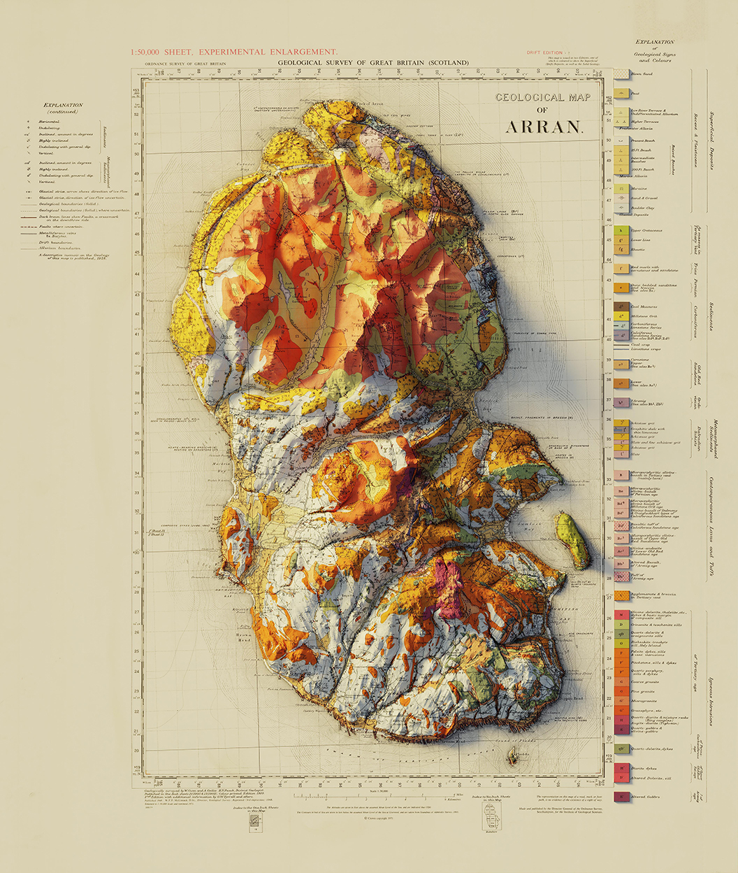
Hillshading and geology
Hillshading is very appealing and informative when used with geology data, particularly in the form of old maps, with fine examples being produced by longitude.one.
An example using The Isle of Arran was found posted on Reddit and posted again below at a smaller size.
Methodology
The map above using hillshading and land cover was created using ArcMap along with the guidance in the following great video from MapPractical.
The data and tools used to create The Isle of Arran map were:
Data
– Digital Elevation Model (DEM): 30-Meter SRTM Tile Downloader
– Land Cover: Copernicus CORINE Land Cover
– Water Bodies: Geofabric Open Street Map Download Server
– Settlements: National Records of Scotland
– Contours, Rivers, Roads, High Points and Coastal Features: Ordnance Survey Open Data
Tools
– Hillshading: Hillshade 9.3 ArcToolbox, Swiss Hillshade Model
