
Properties in Care (PiCs) form a portfolio of historic sites managed by Historic Environment Scotland (HES) on behalf of Scottish Ministers. They represent over 5,000 years of Scotland’s history and are:
“a precious national asset and we (HES) look to protect them for current and future generations”
PiCs and their associated collections are accessible to the public throughout the year.
Information on Scotland’s 336 PiCs, including any entry fees and opening times, is made available via a map and text search. A GIS data download is also available. PiCs are also represented in the National Record of the Historic Environment and the Historic Environment Scotland Portal.
The following maps explore the distribution of PiCs across Scotland.
Distribution of Scotland’s PiCs
At the 10km2 square perspective the Orkney Islands stands out as having a lot of 10km2 squares with a high number of PiCs. Other high numbers of PiCs can be seen in 10km2 squares in and around the eastern central belt and southern Dumfries and Galloway. One 10km2 square in Argyll and Bute also stands out as having the highest number of PiCs.

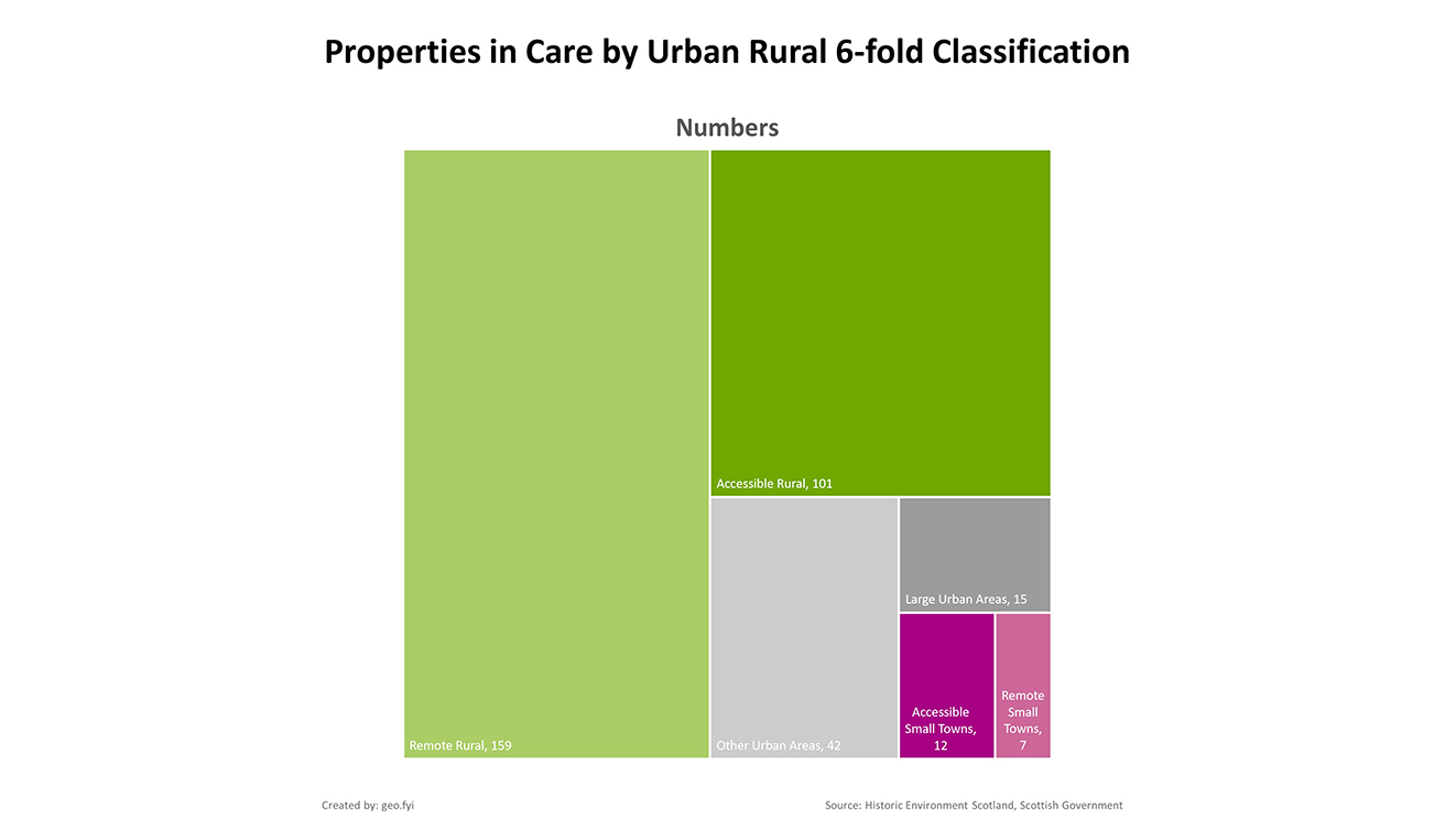
From an urban, small town and rural perspective, PiCs are predominately found in remote/accessible rural areas.
The map below shows the distribution of PiCs by Data Zone. Again, the Orkney Islands stands out with most of its Data Zones containing PiCs. Data Zones in Argyll and Bute, Arran and the southern Dumfries and Galloway also stand out.

From a local authority perspective the the Orkney Islands, Argyll and Bute and Dumfries and Galloway have the highest number of PiCs. East Ayrshire is the only local authority with no PiCs.

