
Remote sensing data in the form of satellite imagery is now common place. This is in part due to the success of Google Maps and Google Earth.
In addition, there is an increasing availability of remote sensing data as three dimensional point clouds from light detection and ranging (LiDAR) systems.
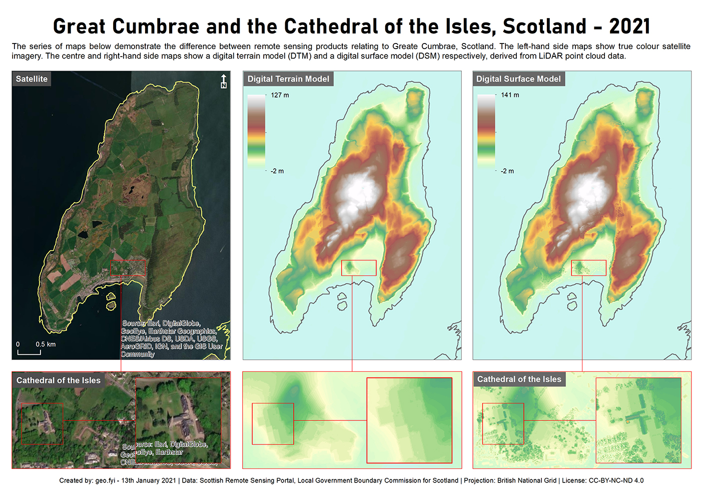
Various parts of Scottish Government procure LiDAR data and it is made available, along with digital terrain model (DTM) and digital surface model (DSM) derivatives, via the Scottish Remote Sensing Portal.
The map below shows a satellite image of Great Cumbrae along side a DTM and DSM derived from LiDAR point cloud data. The DSM clearly shows surface artefacts such the trees and buildings associated with the Cathedral of the Isles. As expected, the DSM maximum height (141m) is greater than the DTM maximum height (127m).
The LiDAR point cloud data itself can be visualised in three dimensions using an application such as lidarview.com.


One Reply to “”