
The Scottish Government Urban Rural Classification provides a standard definition of urban, small town and rural areas of Scotland. The most recent classification exercise was the 2016 Scottish Government Urban Rural Classification published in 2018.
This classification is based on population and accessibility.
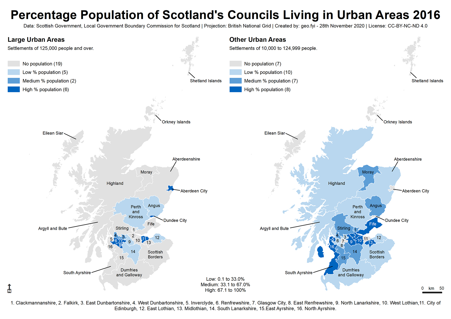
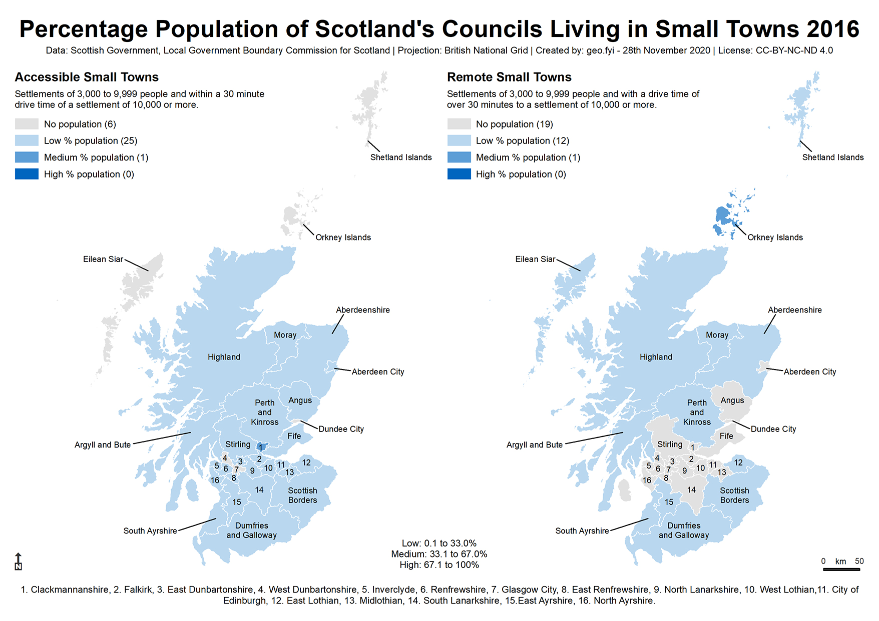
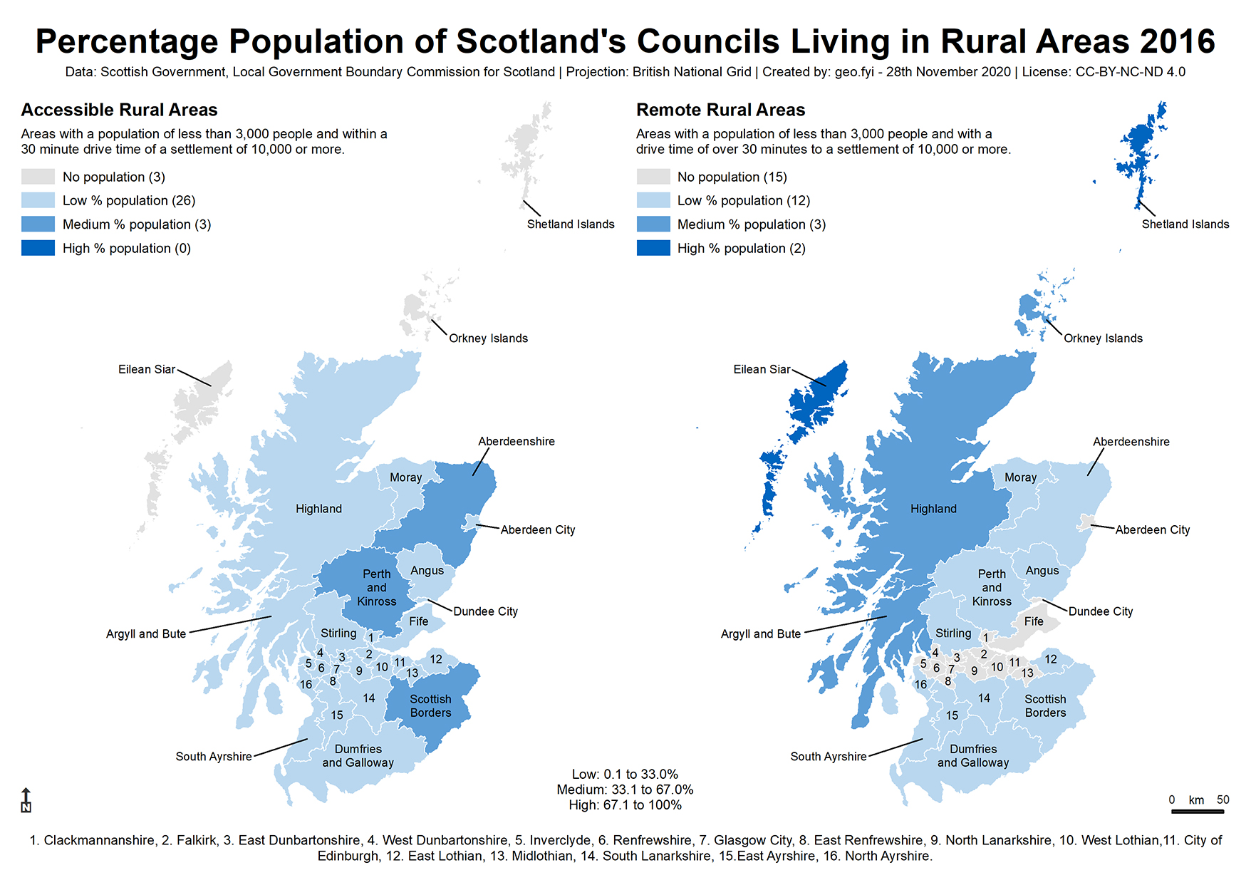
| Population | Using population statistics from the National Records of Scotland (NRS), four settlement classes are defined: 1. Large Urban Areas: Populations of 125,000 or more 2. Other Urban Areas: Populations of 10,000 to 124,999 3. Small Towns: Populations of 3,000 to 9,999 4. Rural Areas: Populations less than 3,000 |
| Accessibility | Using drive time analysis, two accessibility classes are defined: 5. Accessible: Areas within a 30 minute drive time of a settlement with a population of 10,000 or more. 6. Remote: Areas that are more than a 30 minute drive time from a settlement with a population of 10,000 or more. |
Combining the above six classes creates a 6-fold classification system of:
– Large and other urban areas
– Accessible and remote small towns
– Accessible and remote rural areas
Other classification systems exist and the Scottish Government has created an ESRI story map to explain them.
The following maps show the percentage population of Scotland’s councils classified into three equal classifications, living in the four different settlement classes of the 6-fold classification system.
Urban areas
Small towns
Rural areas
See also Rural Scotland: key facts.
